


Essential Skills for Beginners: Comprehensive Guide to Wilderness Orientation
I. Discriminate According to the Sun
In winter, the sun rises in the southeast and sets in the southwest. In summer, it rises in the northeast and sets in the northwest. Around the Spring Equinox and Autumn Equinox, the sun rises due east and sets due west.
II. Using a Watch to Determine Direction
1. Read the current time in 24-hour format. Divide the hour by two.
Place the watch horizontally on your palm or the ground, aligning the resulting hour position with the sun.
The 12 o’clock mark on the watch will point north, and 6 o’clock will point south.
- Between 9 AM and 4 PM, follow this rule: “Halve the hour and align it with the sun; ’12’ points north.”
- For example, at 9 AM, align the 4:30 position with the sun. At 2:40 PM (14:40), align 7:20 with the sun.
To improve accuracy, place a thin stick or blade of grass at the “halved hour” position and ensure its shadow passes through the watch’s center.
Notes:
a. Use 24-hour time (e.g., 1 PM = 13:00).
b. Keep the watch flat (face up).
c. Avoid this method near midday in latitudes between 20°30′ N and 20°30′ S.
d. Account for time zone differences: adjust standard time by ±1 hour for every 15° east/west of the standard meridian.
III. Shadow Stick Method
1. Drive a vertical pole into the ground. In the morning, the shadow points northwest; in the afternoon, it points northeast. The shortest shadow at noon points north.
2. Mark the tip of the pole’s shadow (e.g., with a stone).
After 10–60 minutes, mark the new shadow tip. Draw a line between the two marks, then bisect it with a perpendicular line.
The cross indicates directions: label the second mark as east, then clockwise label south, west, and north.
Higher, thinner poles yield more accurate results, especially around noon.
3. For precision: Mark the morning shadow tip, draw an arc with the shadow length as the radius.
When the afternoon shadow tip intersects the arc, the connecting line between the two points indicates east-west (morning shadow tip = west).
IV. Using Stars
Polaris: Locate the Big Dipper.
Extend the line between the two “pointer” stars (Dubhe and Merak) five times to find Polaris, which marks true north.
Below 40°N, the Big Dipper may dip below the horizon; use Cassiopeia (shaped like a “W”) instead. Its central star points toward Polaris.
Orion: Rises near the celestial equator. Mintaka, its rightmost belt star, aligns roughly with the equator. Orion’s belt and sword aid identification.
Crux: Visible south of 23°30’N. Extend the line from the long axis (Acrux and Gacrux) 4.5 times downward to locate south.
V. Natural Landmarks
1. Trees: Southern sides have denser foliage and smoother bark; northern sides are mossier.
2. Snow melts slower on northern slopes; pits retain snow longer on southern sides.
3. In northern China, temple doors and rural house windows often face south. Mosques face east.
4. Grass grows thicker on the northern edges of forest clearings. Tree rings are wider on the southern side.
5. In deserts, prevailing NW winds shape dunes with gentler NW slopes and steeper SE slopes. Plants lean southeast.
6. Mongolian yurt doors typically face south.
7. Ant nests usually face south.
8. Moss grows on the north side of rocks; south sides are drier.
9. Riverbanks: Northern edges resemble convex terrain.
10. Pine resin accumulates more on southern tree trunks.
11. Secondary bark develops earlier and higher on northern sides.
12. Fruit ripens earlier on southern branches.
13. Compass plants (e.g., wild lettuce) align leaves north-south.
14. Conifers (e.g., firs) thrive on northern slopes; pines prefer southern slopes.
15. Snow melts faster on southern slopes and concave northern terrain.
VI. Using Maps
Contour Lines: Connect points of equal elevation. Closed loops indicate peaks or depressions. Dense lines denote cliffs; sparse lines suggest gentle slopes. Colors shift with altitude (brown to white for snow).
Orientation: Most maps are oriented with north at the top. Use landmarks and a compass to align the map.
Triangulation: Align a ruler on the map between known landmarks and your position. The intersection of two or more lines marks your location. Avoid magnetic interference when using a compass.
VII. Improvised Compass
Magnetize a needle by stroking it unidirectionally with silk or a magnet. Suspend it freely to point north. Re-magnetize periodically.
VIII. Using the Moon
1. The moon rises 48–50 minutes later daily. Phases: waxing (right side lit before full moon), waning (left side lit after).
2. If the moon rises before sunset, its lit side faces west; if after sunset, lit side faces east.
3. Estimate direction by calculating the moon’s hourly 15° westward movement.
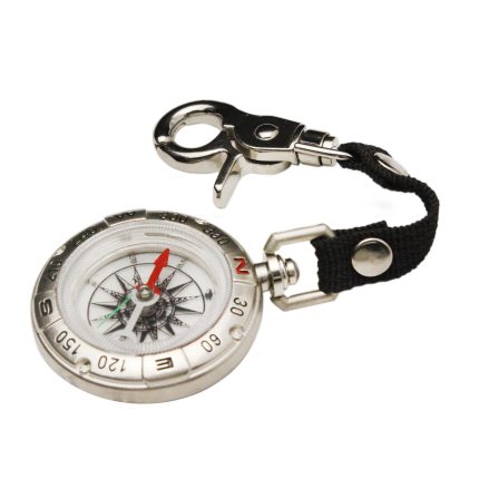
IX. Compass Use
Level the compass, let the needle settle, and align the “N” mark with magnetic north. Correct for local magnetic declination. Avoid metal interference.
X. Wind and Terrain Clues
- Windward slopes are smoother; leeward slopes are steeper.
- In deserts, dunes align with prevailing winds (e.g., NW-SE in China’s northwest).
- Follow animal tracks or vegetation patterns to find water.
Tips for Navigation:
- Ascend high ground to scout routes. Follow rivers downstream.
- In deserts, use “handrailing” (follow linear features) to avoid circles. Mark your path.
- In forests, backtrack using tree markings. Avoid animal trails.
- Signal for help: Smoke by day (6 puffs/minute), fire by night.
XI. Time Determination
- Big Dipper Clock: Imagine Polaris as the center. The line from Dubhe/Merak to Polaris acts as an hour hand. Adjust for local longitude.
Formula: *Beijing Time = 36.4 – Longitude (hours) – 2*(Star Hour + M)*, where M = months since January 1.
- Cassiopeia Clock: Use the central star as the hour hand. Formula replaces 36.4 with 25.5.
- Star Dial: Align a custom dial with celestial markers for quick time estimation.
Note: All methods have ~15-minute error margins. Adjust for local conditions and practice regularly.